Topic: Maps-Maps-Maps! ?  (Read 78520 times)

Re: Maps-Maps-Maps! ?

Reply #100


A billion people in the Americas?
No.
With Australia and New Zealand together.


I rest my case. Without a legend, the pretty colors don't mean much.

I suppose Australia and New Zealand have to be with somebody else to get to a billion, most of Australia's population is on its Eastern coast-- the outback not being overpopulated--. New Zealand is a couple of rather small islands so of course it doesn't have a lot of people.


Your point is taken.
Pertaining to the thread, you're right about the necessity of legends; while the tripe about the number of people is derivative from a questionable map.

Re: Maps-Maps-Maps! ?

Reply #101
I suppose Australia and New Zealand have to be with somebody else to get to a billion, most of Australia's population is on its Eastern coast-- the outback not being overpopulated--. New Zealand is a couple of rather small islands so of course it doesn't have a lot of people.

I believe the two together house about as many people as the Benelux (i.e. approximately 28 million). That's not quite as much cause for nitpicking as the hundreds of millions in the Middle East that bring "Europe" to a billion. ;)

Re: Maps-Maps-Maps! ?

Reply #102
A good geographical map needs to have altimetric curves.
A matter of attitude.

Re: Maps-Maps-Maps! ?

Reply #103
I rest my case. Without a legend, the pretty colors don't mean much.

I suppose Australia and New Zealand have to be with somebody else to get to a billion, most of Australia's population is on its Eastern coast-- the outback not being overpopulated--. New Zealand is a couple of rather small islands so of course it doesn't have a lot of people.


The pretty colours is the legend. How the world actually is grouped into 100 million people, 1 trillion $, or 1000 million people is ultimately arbitrary, you could gerrymander the regions if you were so inclined, but it wouldn't be telling you as much as more "natural" divisions.


The population of Australia is 0.02 billion, the population of New Zealand, Greenland, and Iceland is 0.00 billion each. They could be grouped with any billion without tipping the scale. It is a question of the mapographer's taste/whim.

The billion people guy presumably thought of Oceania as New World (a cultural distinction, and Australia in particular is very old world as far as human culture is concerned), but bunched Greenland and Iceland with the Americas, which is a geographical grouping (Iceland is on the Mid-Atlantic Ridge, and could go either way).

The other two maps were grouped differently as far as these countries (and others, of course) are concerned.


A better criticism of the maps might be the choice of projection used. It uses equirectangular projection, which distorts the areas depending on the location on the planet, regions near the poles seem larger and wider. Since these three maps compare areas (smaller areas have higher population/economic density), a projection that didn't distort areas might be preferred, for instance this one:


Re: Maps-Maps-Maps! ?

Reply #104
The population of Australia is 0.02 billion, the population of New Zealand, Greenland, and Iceland is 0.00 billion each. They could be grouped with any billion without tipping the scale. It is a question of the mapographer's taste/whim.

The billion people guy presumably thought of Oceania as New World (a cultural distinction, and Australia in particular is very old world as far as human culture is concerned), but bunched Greenland and Iceland with the Americas, which is a geographical grouping (Iceland is on the Mid-Atlantic Ridge, and could go either way).

I don't know; the Americas by themselves are actually estimated to be just about 50 million short of a billion. Adding most of Oceania and other Pacific islands does nicely top it off to one billion.

Re: Maps-Maps-Maps! ?

Reply #105
But that is small change, the numbers aren't fixed, and will change a day or a month from now. The Americas will still remain "roughly one billion" next decade as well.

Interestingly, according to Google, the world GDP was 72 trillion in 2012. That means that it is not illusion that the number of areas in the two look so similar, they are similar, around 70 (72) in total that year.


The world divided into areas of 100 million people


The world divided in areas of 1 trillion dollar GDP


We could group the economic map into 7 areas of 10 trillion to create an economic grouping of seven like the billion map. Then South America would have about 1/2 (like the population), North and Central America 1 1/2, Europe another 2. Just like Asia dominates world's population, North America and Europe still dominate the world's economy, while Africa, South and South-East Asia have minimal economic impact (for the time being).

Re: Maps-Maps-Maps! ?

Reply #106
Those maps are very strange.
The first one, 100 million people areas, each area with a certain color.

So, Portugal (10 miilion) + a part of Spain (60 million in total, the selected part it's the less populated let's estimate 20 millions) + Ireland (6 million) + Greenland (what? five thousand people there?) + Canada (35 million) =70 million.
So, not enough, let's add Alaska too. Not enough.
That African part around Angola, in the same blue color, also counts?

And why not to add Sri Lanka, Vanuatu, etc?
Strange criteria to compose zones indeed.
A matter of attitude.

Re: Maps-Maps-Maps! ?

Reply #107
Yes, some of these territories were oddly chosen, and the Portugal-to-Alaska area probably the strangest of them all. I think it was meant as a Trans-Atlantic area to take the "leftover population" from Europe and North America, but that it fell short and went all the way to the Bering Strait.

Re: Maps-Maps-Maps! ?

Reply #108
I also seem to be getting the impression that Germany on that 100 million map looks suspiciously like the German Empire.


Re: Maps-Maps-Maps! ?

Reply #111

http://www.boredpanda.com/interesting-maps/

This collection of maps looks like a summary of what jax has posted over the past few months.


I think around half of those maps I've posted in this thread have been recycled through the reddit-imgur complex (including bored panda, though not many by that site). I'm not sure if that is a good or bad thing.

Re: Maps-Maps-Maps! ?

Reply #112
Does anyone ever heard about the maps of Piri Reis?
A matter of attitude.

Re: Maps-Maps-Maps! ?

Reply #113
Piri Reis is interesting, but I have found I am the only one interested in it. What about it, Belfrager?


Re: Maps-Maps-Maps! ?

Reply #114
Well, you point it very well Ersi.

Besides the extreme beauty of his maps, they had a very high level of detail for the time being and, specially, it were the first maps to integrate a global vision that made coherency to partial views from other navigators.

A certain discussion was maintained for some time that Piri Reis was aware of geographical facts that European navigators couldn't know about but that was not true.

Being an Ottoman he also gave a couple headaches to the Portuguese, but that you don't need to know. :)

Anyway, I thought his maps were a delightful counterweight to the technical data driven maps we use to see here.

A matter of attitude.

Re: Maps-Maps-Maps! ?

Reply #115
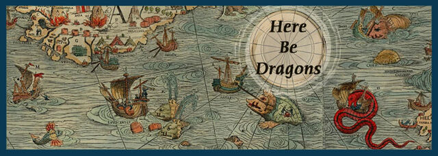
In my last "job", I used the Chicagoland 7-County Atlas. It was good for a few years but then started to drop off at the outer counties. The last copy I have has about half of Kane County missing, a sizable chunk of Will County missing, and don't get me started about what the map guys did to McHenry County. It didn't help that, in place of roads they used to show, they had "Here thar be dragons" listed in the margins. With drawings of what the dragon might look like.

A real pity, too. During the peak time for these maps, they were the best tools I could lay my hands on. Now they're nearly useless for anything outside of Cook and Du Page Counties, and I wouldn't rely too heavily on these atlases for Du Page County, either.

Hmmm..... could that be a dragon's lair I see beyond Ill. Rte 47?

What would happen if a large asteroid slammed into the Earth?
According to several tests involving a watermelon and a large hammer, it would be really bad!

Re: Maps-Maps-Maps! ?

Reply #116

I also seem to be getting the impression that Germany on that 100 million map looks suspiciously like the German Empire.

Pure coincidence I'm sure :right:

Re: Maps-Maps-Maps! ?

Reply #117

Being an Ottoman he also gave a couple headaches to the Portuguese, but that you don't need to know. :)

Yeah, their intelligence service seems to have worked quite well ( or they were really good at keeping their exploration trips a secret ) :right:


Re: Maps-Maps-Maps! ?

Reply #119

Does anyone ever heard about the maps of Piri Reis?
Is that the person who created those freakishly detailed maps of Antarctica, very popular among Atlantis enthusiasts?

Btw, do you know the Dutch and German word for travel or journey? ;)

Re: Maps-Maps-Maps! ?

Reply #120


Does anyone ever heard about the maps of Piri Reis?
Is that the person who created those freakishly detailed maps of Antarctica, very popular among Atlantis enthusiasts?

Not sure if you are kidding or the rumours really go this way in your area. Piri Reis created the map of central areas of Atlantic ocean, not the entire ocean. If he did more, it's not preserved, but the extant copies imply he didn't get anywhere near Antarctica.

Still, the preserved work is nicely detailed. So detailed that it's a wonder why Arabs didn't manage to conquer the Atlantic the way they had the Indian ocean.

Also the commentaries in the map are interesting. Among other things, it says that a guy called Colombo found a book that said there were treasure islands to the other side of the Atlantic. Inspired by this book, he nagged on the King and Queen of Spain until he got ships to go find the treasure islands.


Btw, do you know the Dutch and German word for travel or journey? ;)

The same word has been incidentally borrowed into Estonian. Piri Reis sounds like "border trip". Wikipedia says the ruler of Egypt had him beheaded because he refused to engage another campaign against the Portuguese.

Re: Maps-Maps-Maps! ?

Reply #121
Not sure if you are kidding or the rumours really go this way in your area. Piri Reis created the map of central areas of Atlantic ocean, not the entire ocean. If he did more, it's not preserved, but the extant copies imply he didn't get anywhere near Antarctica.

I have no idea what "area" Atlantis, UFO and whatnot enthusiasts live. I imagine they're spread throughout the world. Though I probably should've put some kind of quotes (although it's not a literal quotation) around "freakishly detailed".

The same word has been incidentally borrowed into Estonian. Piri Reis sounds like "border trip". Wikipedia says the ruler of Egypt had him beheaded because he refused to engage another campaign against the Portuguese.

I only know the word piri from piri piri. So I guess Piri Reis sounds like "hot pepper journey". However, something like "Piri Reis-kaart" sounds a bit like a map of the Piri journey. However, it would be far more idiomatic to use that latter turn of phrase, "kaart van de Pirireis".

Re: Maps-Maps-Maps! ?

Reply #122

I have no idea what "area" Atlantis, UFO and whatnot enthusiasts live. I imagine they're spread throughout the world.

When I said "your area", I was pointing out the fact that the enthusiasm of Atlantis enthusiasts who were also enthusiastic about the map of Piri Reis has reached you, but hasn't reached me. Could be the kind of circles of people we have contact with or the kind of books we read. I did not imply that you were one of them, even though I admittedly made it sound like they could be your neighbours or so. It should be clear enough that you are not necessarily similar in any way to your neighbours.

Anyway, I can be more readily described as an Atlantis enthusiast, because I have a few books that mention Atlantis. One of them a huge book of photos, titled The Atlas of Atlantis. Somehow it doesn't mention the map of Piri Reis though, IIRC. And I have no contact with any real-life Atlantis enthusiasts, so I am not properly in their club.


Re: Maps-Maps-Maps! ?

Reply #124
Somehow it doesn't mention the map of Piri Reis though, IIRC.

Quote from: Charles Berlitz, The Bermuda Triangle (1974)
The Piri Reis Map, found in Istanbul in 1929, is part of a world map said to have been copied from a Greek original in the Library of Alexandria. Among other features, the Piri Reis map shows detailed features of Antarctica evidently drawn several thousand years before Antarctica was “discovered,” as well as the true shape of Antarctica without the covering ice. Other features indicate an advanced knowledge of astronomy, trigonometry,  and  the ability to determine longitude, not known to our culture until the reign of George III of England.

[Edit: more here]

Sarcasm tags?

Something like that. :lol: